Purva District Connectivity
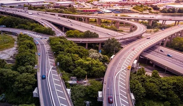
Purva District connectivity centres on NH-44 (Bellary Road), with the Bangalore airport about 8 to 10 km away. That is roughly a 10-minute drive. From Sanna Amanikere, you can reach Hebbal, Manyata Tech Park and Hoskote by highway and ring road. The airport metro line will add one more route.
For most buyers, connectivity decides whether a home works for daily life. This guide maps every route out of the project and the distance to key places. It also shows how new roads and the metro will change your commute in the coming years.
Purva District Distance Chart
The table below lists the places you are most likely to travel to. Distances are approximate road distances, and drive times are off-peak estimates.
| Destination | Approx. Distance | Approx. Drive Time (Off-Peak) |
|---|---|---|
| Kempegowda International Airport | 8 to 10 km | About 10 minutes |
| KIADB Aerospace Park and SEZ | About 6 km | 10 to 15 minutes |
| Devanahalli town | 5 to 10 km | 10 to 20 minutes |
| Hardware Park, Bagalur belt | 8 to 10 km | 15 to 20 minutes |
| Manyata Tech Park | 25 to 30 km | 40 to 50 minutes |
| Hebbal flyover | 25 to 30 km | 35 to 45 minutes |
Peak-hour trips into the city take longer, mainly south of Hebbal. If you work north of Hebbal, though, your daily drive stays short and easy to plan.
Road Connectivity
NH-44 (Bellary Road)
The project sits just off NH-44, the six-lane highway that runs from Hebbal to the airport and beyond. This road takes you into north Bangalore with few signals on the way. It also links you to Yelahanka, Jakkur and the Hebbal flyover.
Satellite Town Ring Road
The Satellite Town Ring Road links Doddaballapur and Hoskote and passes close to Devanahalli. Once it is fully open, you can reach Whitefield through Hoskote. That means you skip the city core on the way to the east side.
Airport Access Roads
Apart from NH-44, the airport has other access routes from the east through Hennur and Bagalur. These give you a second way to reach the terminals when the main highway is busy.
Metro Connectivity
The Namma Metro Blue Line will link KR Puram and Hebbal to the airport. The full line runs about 38 km with 16 stations. It ends at the airport terminals, about 8 to 10 km from the project.
Work on this line began in February 2022. BMRCL's targets for opening the airport section have moved between 2027 and 2028. Once it opens, you get a traffic-free ride to Hebbal, where you can change to other lines. Treat the metro as a strong future upgrade rather than a fixed date.
Rail Connectivity
Devanahalli railway station sits on the line between Bangalore and Chikkaballapur. The KIA Halt station near the airport also has local train services. These stations give you a cheap backup route into the city, though trains still run at low frequency.
Schools Near Purva District
If you have school-going children, the area already has well-known options within a fair drive. Distances are approximate road distances from the project.
| School | Approx. Distance |
|---|---|
| Akash International School | 5 to 12 km |
| Stonehill International School | 10 to 14 km |
| Canadian International School | 12 to 16 km |
| Vidyashilp Academy | 12 to 16 km |
| REVA University | 16 to 20 km |
Hospitals Near Purva District
Quick access to a hospital is a key check for families and older parents. These hospitals serve the project area.
| Hospital | Approx. Distance |
|---|---|
| Akash Hospital and Institute | 5 to 10 km |
| Cytecare Cancer Hospital, Yelahanka | 16 to 20 km |
| Columbia Asia Hospital, Hebbal | 22 to 26 km |
| Aster CMI Hospital, Hebbal | 24 to 28 km |
How Connectivity Shapes Life at Purva District
Good connectivity changes more than your commute. It shapes how often you see family and how easily guests reach you. It also affects how much rent you can earn if you lease the home out.
Purva District gains most from its spot between the airport and the aerospace belt. If you work at the airport or the Aerospace Park, your office is under 20 minutes away. Frequent flyers also skip the long airport run that south Bangalore residents face before every trip.
The project balances access with space as well. Its 9.73 acres keep about 75% open land, so your home stays quiet while the highway stays close. As the metro and ring road grow, more parts of the city will reach you with ease. That growth also supports the value story in our Purva District investment guide.
Where Connectivity Still Needs Work
An honest view helps you plan your commute. Trips to south Bangalore, Electronic City or Outer Ring Road stay long for now. You either cross the city or take the ring road. Public transport also stays thin until the airport metro opens.
If you work in these areas, do a test drive at your normal office time before you decide. You can book a site visit and get directions on the Purva District project page. Our Purva District reviews also weigh the location against the project's other strengths.
FAQs
Purva District is about 8 to 10 km from Kempegowda International Airport. The drive takes roughly 10 minutes via NH-44 in normal traffic. That makes the airport closer to you than to most parts of Bangalore.
Purva District is in Sanna Amanikere, off NH-44 (Bellary Road), in Devanahalli, North Bangalore. The address falls under Bengaluru Rural district, Karnataka 562110, close to the KIADB Aerospace Park.
The Namma Metro Blue Line will end at the airport, about 8 to 10 km from the project. The airport section is under construction. BMRCL's opening targets for it range from 2027 to 2028.
Manyata Tech Park is about 25 to 30 km from Purva District via NH-44. Off-peak, the drive takes roughly 40 to 50 minutes. Peak-hour trips can take longer, mainly near Hebbal.
Akash International School sits 5 to 12 km away. Stonehill International School is 10 to 14 km out. Canadian International School and Vidyashilp Academy both sit within 12 to 16 km.
The Satellite Town Ring Road links Doddaballapur and Hoskote. You can reach Whitefield and east Bangalore through Hoskote without crossing the city core. That cuts travel time if you work on the eastern side.